
Standard Operating Procedures of Drone Survey in Mine Area, GoI
Standard Operating Procedures of Drone Survey in Mine Area, GoI. Standard Operating Procedures under sub rule (5) of rule 34A of MCDR, 2017 for carrying
Standard Operating Procedures of Drone Survey in Mine Area, GoI. Standard Operating Procedures under sub rule (5) of rule 34A of MCDR, 2017 for carrying

ESRI Shapefile is a file format that is widely used in the field of geographic information systems (GIS) to store and manage spatial data. It
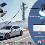
Global Positioning System, also known as GPS, is a satellite-based navigation system that is used to determine the location and time information of an object
In brief ESA Academy is proud to announce that university students may now apply for the pilot edition of the Space Weather Training Course, to
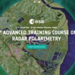
The European Space Agency (ESA) is organizing the 7th ESA Advanced Course on Radar Polarimetry for training the next generation of Earth Observation (EO) scientists in
Flood: a natural disaster Flooding is a recurring natural disaster in the Indian subcontinent, affecting millions of people’s lives, infrastructures, economics, and local ecosystems. The
The UK’s space sector is fast growing, globally competitive, and increasingly important to all parts of our economy, national security, and everyday life. The UK
The leaflet is a popular open-source JavaScript library used for creating interactive maps on websites. It is widely used in GIS applications and data visualization
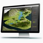
Popular GIS software include Esri ArcGIS, QGIS, AutoCAD Map 3D, MapInfo Professional, Global Mapper, ENVI, PCI Geomatica, Grass GIS, ENVI LiDAR, and Surfer. Each software offers different tools for data management, spatial analysis, cartography, and mapping.
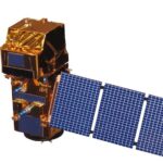
Sentinel-2 is a European Union Earth Observation program with two satellites (S2A & S2B) providing high-resolution optical imagery for environmental monitoring. The MSI instrument aboard has 13 spectral bands, with a spatial resolution of 10-60 meters, and a revisit time of 5 days at the equator. Data from Sentinel-2 is used for a range of applications, including agriculture, forestry, natural resources management and urban planning.

Geospatial intelligence (GEOINT) is the collection, analysis, and interpretation of data from Earth-based and space-based sources to provide insights into the physical features and activities
An honorary doctorate is an esteemed academic recognition that is awarded to outstanding individuals who have made significant contributions to society or a specific field.
Remote Sensing of Environment Journal Remote Sensing of Environment (RSE) serves the Earth observation community with the publication of results on the theory, science, applications, and
What is the Geospatial Bill of India 1.2. The National Geospatial Policy, 2022 (the Policy) is a citizen-centric policy that seeks to strengthen the Geospatial
Organization: Indian Institute of Remote Sensing (IIRS) Location: Dehradun, India Close Date to Apply: 09 October 2021 at 1730 hrs Indian Institute of Remote Sensing

Mahatma Gandhi Employment Guarantee Act 2005 (or, NREGA No 42, later renamed as the “Mahatma Gandhi National Rural Employment Guarantee Act” or MGNREGA), is an Indian
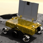
Announcement of Opportunity (AO) to utilize Chandrayaan-2 data: The Chandrayaan-2 mission was successfully launched on 22nd July 2019 at 14:43 hrs by GSLV MkIII-M1 from
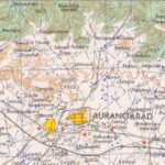
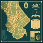
What is Toposheets / Topographical sheets/ Topographic maps? Topographic maps or topographic sheets or toposheets are a detailed information of a land area, giving geographic positions

Online Registration Form Course Brochure Course Schedule Please Note: This course is only for the candidates with minimum qualification of Graduate FAQ: Other Articles:
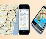
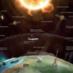
Satellite navigation is an emerging system that provides accurate geospatial position (location) information in the form of latitude, longitude, and altitude. This system can be
We have detected that you are using extensions to block ads. Please support us by disabling these ads blocker.
