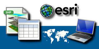
ESRI Shapefile is a file format that is widely used in the field of geographic information systems (GIS) to store and manage spatial data. It is a vector data format that can represent point, line, or polygon features, along with their associated attributes. In this article, we will discuss the features, benefits, and limitations of ESRI Shapefile.

Features of ESRI Shapefile
Geometry types:
ESRI Shapefile can store different types of geometry, including points, lines, and polygons. Points represent discrete locations on the Earth’s surface, such as the location of a city or a well. Lines represent linear features, such as roads or rivers, while polygons represent enclosed areas, such as states or countries. The ability to store different types of geometry makes ESRI Shapefile a versatile format for representing spatial features.
Attribute data:
ESRI Shapefile can store attribute data associated with the spatial features. For example, a point feature might have attributes such as name, address, and phone number. An attribute table is linked to the spatial data, allowing users to view and analyze both spatial and non-spatial data. This allows users to combine and analyze different types of data, such as demographic information and location-based data, to gain insights into different phenomena.
Multiple files :
ESRI Shapefile consists of several files that work together to represent the geospatial data. These files include a main file with a .shp extension that stores the geometry, an index file with a .shx extension that allows for faster searching of the main file, and a database file with a .dbf extension that stores the attribute data. This structure ensures that the spatial data and attribute data remain linked and consistent.
Compatibility:
ESRI Shapefile is widely supported by GIS software and can be easily transferred between different systems and platforms. This makes it a popular choice for sharing geospatial data. It can be read and written by almost all GIS software applications, including open source software like QGIS and commercial software like ArcGIS.

Benefits of ESRI Shapefile
Ease of use:
ESRI Shapefile is a relatively simple file format to use and understand, which makes it accessible to a wide range of users. It is easy to create, edit, and analyze Shapefiles using GIS software. Additionally, the attribute data can be easily edited using spreadsheet software like Microsoft Excel, making it a flexible and user-friendly format for storing and managing data.
Versatility:
ESRI Shapefile is a versatile file format that can represent a wide range of spatial features, including points, lines, and polygons. This makes it useful for a variety of applications, such as mapping, planning, and environmental management. Its ability to store both spatial and attribute data in a single file also makes it a convenient format for data management and analysis.
Interoperability:
ESRI Shapefile is widely supported by GIS software and can be easily transferred between different systems and platforms. This makes it a popular choice for sharing geospatial data. Its compatibility with various GIS software applications ensures that data can be easily shared and analyzed by different users and organizations.
Limitations of ESRI Shapefile
File size:
One major limitation of ESRI Shapefile is that it has a maximum file size of 2 GB. This can be a problem when working with large or complex datasets, such as high-resolution imagery or detailed maps. In such cases, other file formats like GeoTIFF or GeoPackage may be more suitable.
Data complexity:
ESRI Shapefile is not suitable for storing highly complex data such as 3D models or topological data. It is a flat file format and cannot store relationships between features, which can lead to data loss or corruption when attempting to store complex data. Additionally, ESRI Shapefile cannot store raster data, which limits the types of data that can be represented in this format.
Limited metadata
ESRI Shapefile has limited support for metadata, which describes the properties and characteristics of the spatial data. While metadata can be included in ESRI Shapefile, it is not a requirement and is often overlooked by users. This can make it difficult to understand the context and accuracy of the data, which can be problematic when making decisions based on the data.
Lack of standardization
ESRI Shapefile is not an open standard, meaning that its development and maintenance are controlled by a single organization (ESRI). This can lead to compatibility issues and limits the ability of other organizations and developers to contribute to its development. Additionally, ESRI Shapefile does not support international characters, which can be a problem when working with non-English data.
Conclusion
ESRI Shapefile is a widely used file format for storing and managing spatial data. It is a versatile and user-friendly format that can represent a wide range of spatial features and attribute data. Its compatibility with various GIS software applications makes it a popular choice for sharing geospatial data. However, it also has some limitations, including its file size and inability to store complex data. Despite these limitations, ESRI Shapefile remains a popular choice for GIS users due to its ease of use and interoperability.
In recent years, there has been a shift towards using open standards for geospatial data, such as GeoJSON, GeoPackage, and KML. These formats offer several advantages over ESRI Shapefile, including better support for complex data, improved metadata, and international character support. However, ESRI Shapefile remains a widely used format due to its long history and familiarity among GIS users.
ESRI has also introduced a newer file format called the Geodatabase, which is designed to address some of the limitations of ESRI Shapefile. Geodatabase supports more complex data structures, including topology and network data models, and can handle larger datasets. However, it requires specialized software and can be more difficult to work with than ESRI Shapefile.
Download Shapefile


