
Satellite navigation is an emerging system that provides accurate geospatial position (location) information in the form of latitude, longitude, and altitude. This system can be utilized for navigation (object tracking) and positioning purposes.
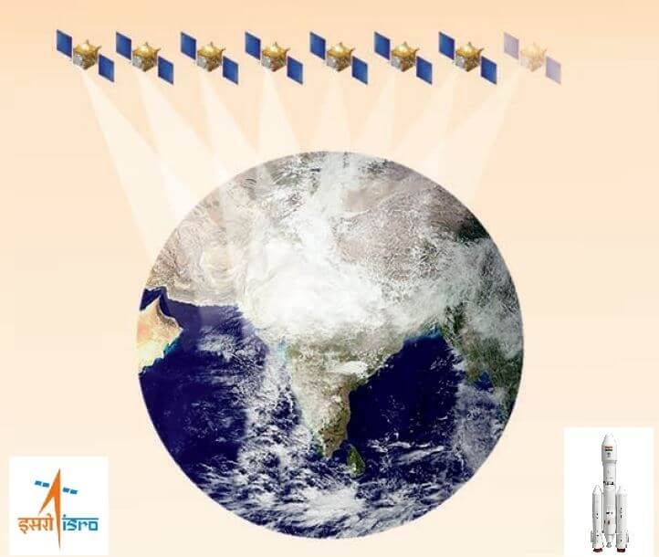
The Indian Space Research Organization (ISRO) has developed a regional satellite navigation system called the Indian Regional Navigation Satellite System (IRNSS) to meet the user requirements of the positioning, navigation, and timing services based on the indigenous system.
Indian Regional Navigation Satellite System (IRNSS): NavIC
The IRNSS was renamed as “NavIC” (Navigation with Indian Constellation) by the India’s Honourable Prime Minister, Mr. Narendra Modi. Its objective is to provide precise geospatial position information service to users in India (less than 10 m accuracy) as well as covering a distance of about 1500 kms across India with better accuracy than 20 m. (Indian GPS satellite)
Basically, two types of services will be provided by IRNSS.
- Standard Positioning Service (SPS): To provide services to all the users of the coverage area.

2. Restricted Service (RS): It is an encrypted service that will be provided only to the authorized users.
Applications of NavIC:
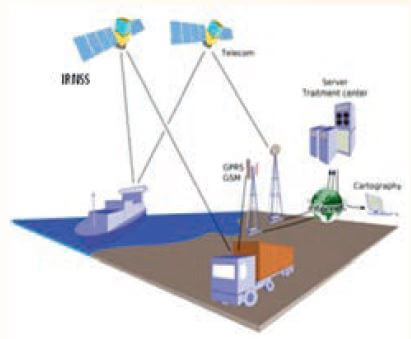
- Terrestrial, Aerial and Marine Navigation
- Disaster Management
- Vehicle tracking and fleet management
- Integration with mobile phones
- Precise Timing
- Mapping and Geodetic data capture
- Terrestrial navigation aid for hikers and travellers
- Visual and voice navigation for drivers
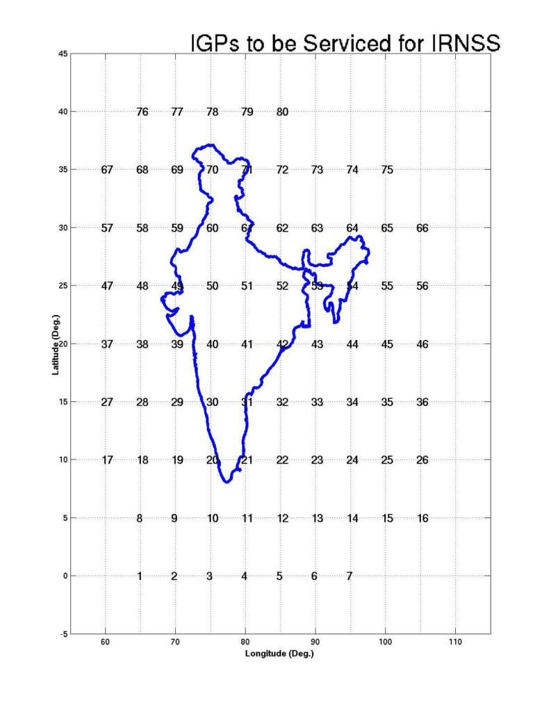
Service Area of IRNSS (NavIC)
NavIC service area includes India and 1500 kilometres around the Indian boundary; the extended service may also be obtained over a region lying between 30 S to 50 N Latitude and 30 E to 130 E (Source: ISRO/ S. Dan et. al., 2020).
Segment of NavIC (IRNSS), ISRO
- Space Segment of NavIC: 3 of the 7 satellites are geostationary orbit (GEOs) and they are located at 32.5º East, 83º East and 131.5º East longitude. There are 4 geostationary satellites (GSO) in orbits of 24,000 km apogee and 250 km perigee inclined at 29 degrees.
- Ground Segment of NavIC:
- ISRO Navigation Centre
- IRNSS Spacecraft Control Facility
- IRNSS Range and Integrity Monitoring Stations
- IRNSS Network Timing Centre
- IRNSS CDMA Ranging Stations
- Laser Ranging Stations
- Data Communication Network

ISRO assist chipmaker to enable Indian GPS, NavIC (IRNSS) system in launch of compatible mobile chipset
ISRO has provided consultation for Qualcomm towards enabling NavIC capability in their Snapdragon mobile chipset. These chipsets are being released by Qualcomm Technologies, Inc. Which will support India’s own navigation system NavIC (IRNSS) like the US Global Positioning System (GPS). It will accelerate the adoption of NavIC by smartphone original equipment manufacturers (OEMs).
“The OEMs can now release any new models for Indian market which are NavIC enabled, thus eventually making NavIC as a standard feature in the upcoming handsets, applications, processors, etc. It will also enhance the geolocation capabilities of smartphones within the coverage region of NavIC.” (Source: ISRO dt. Jan 21, 2020).
Qualcomm Technologies, Inc. announced the launch of three new mobile platforms: The Qualcomm® Snapdragon™ 720G, 662 and 460. These new mobile platforms enable the first system-on-chip solutions to support Navigation with Indian Constellation (NavIC).

“ISRO urge OEMs to leverage it for future handset launches in India. The availability of NavIC across multiple mobile platforms will help enhance the geolocation capabilities of smartphones in the region and bring the benefits of this indigenous solution to Indian consumers for their day-to-day use” (Source: ISRO dt. Jan 21, 2020 & Qualcomm Technologies).
Garmin launches ISRO’s NavIC system enabled Handheld Devices: GPSMAP 66sr and GPSMAP 65s
Garmin Ltd. is an American multinational technology which is specialized in GPS technology for automotive, aviation, marine, outdoor, and navigation products. Garmin Ltd. has recently launched ISRO’s NavIC (IRNSS) enabled handheld devices GPSMAP 66sr and GPSMAP 65s in India.
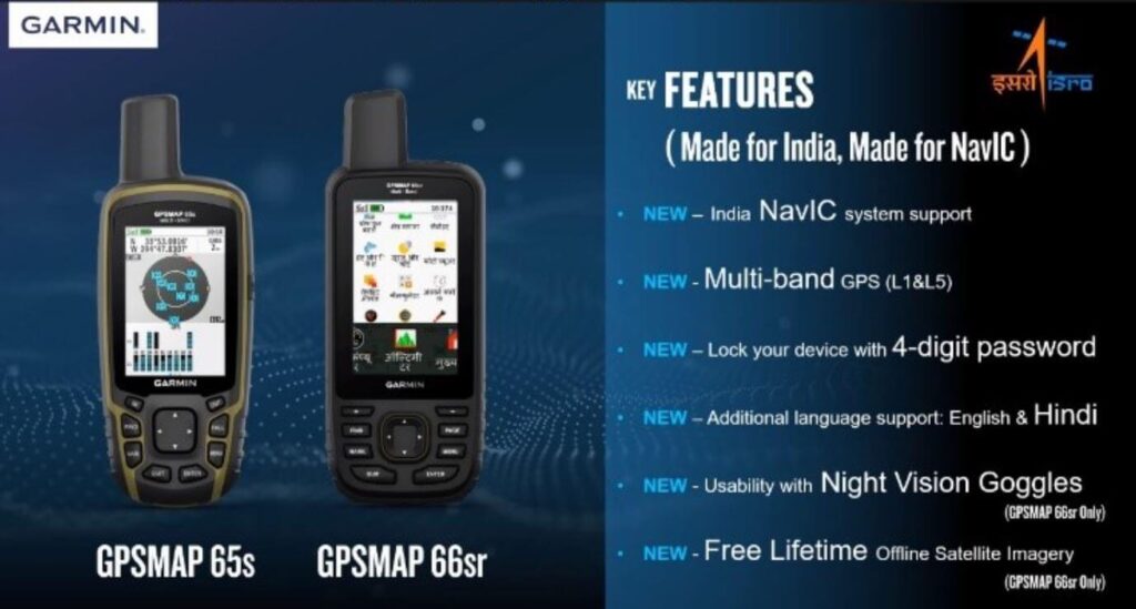
It will enhance the accuracy and availability of signals in the hilly terrain as well as urban area. Which will be crucial help in vehicle tracking, fleet management, disaster management, terrestrial navigation aid for hikers and travellers. ISRO also urged Garmin to incorporate indigenous NavIC systems in upcoming satellite navigation-based instruments to be launched in India (Info. source: ISRO, dt. Jul 02, 2021).
- List of Navigation Satellites
- Number of satellites in IRNSS
What does NavIC mean?
The Indian Space Research Organization (ISRO) has developed a regional satellite navigation system called the Indian Regional Navigation Satellite System (IRNSS) .
The IRNSS was renamed as “NavIC” (Navigation with Indian Constellation) by the India’s Honourable Prime Minister, Mr. Narendra Modi.
Does India have own GPS Navigation System?
Yes, The Indian Space Research Organization (ISRO) has developed a regional satellite navigation system called the Indian Regional Navigation Satellite System (IRNSS).
The IRNSS was renamed as “NavIC” (Navigation with Indian Constellation) by the India’s Honourable Prime Minister, Mr. Narendra Modi.
What does IRNSS mean?
The Indian Space Research Organization (ISRO) has developed a regional satellite navigation system called the Indian Regional Navigation Satellite System (IRNSS).
How many satellites are being used in IRNSS?
A total of 09 satellites have been developed by ISRO for the IRNSS series. Which at present 08 are in orbit. 3 satellites in geostationary orbit.
NaviC supported phones company.
Samsung is planning to build the chipset, NavIC support requires an antenna, filters, and related radio frequency components.
Similar Arcticles
- West Bengal Map
- Geospatial Intelligence and Machine Learning Applications in the Air Force: An In-Depth Analysis
- Remote Sensing of Environment
- Geospatial Bill of India 2022
- Free online Remote Sensing and GIS Certification by IIRS-ISRO | 91th सुदूर संवेदन एवं जीआईएस प्रौद्योगिकी के मूल सिद्धांत पर दो सप्ताह का पाठ्यक्रम (सितंबर 14 -28, 2021)

I would like to be part of NavIC development.