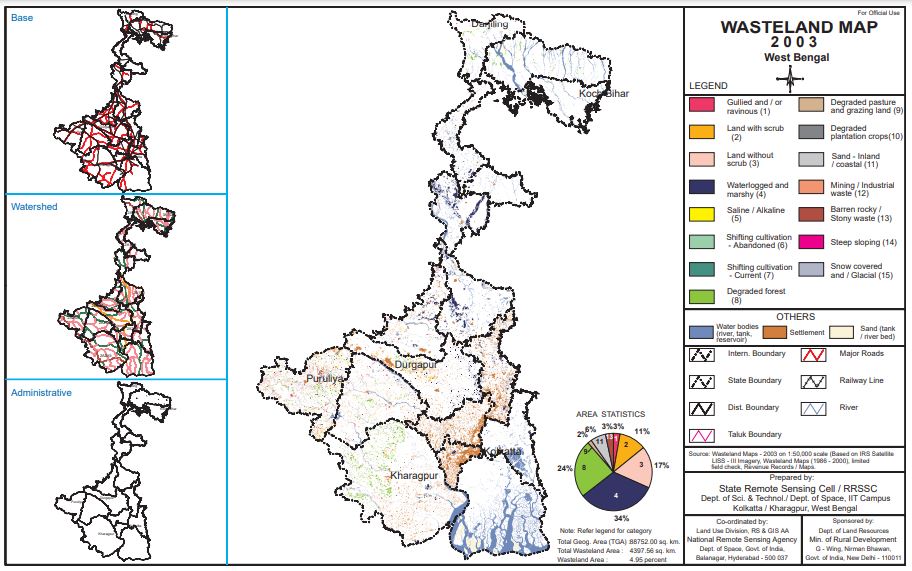
West Bengal Map
West Bengal is a state in eastern India (West Bengal Map). It is bordered by Bangladesh to the east, Assam and Sikkim to the north, Bhutan to the northeast, Jharkhand…
GIS Vacancy - A Remote Sensing and GIS Jobs Platform
Fast GIS Jobs alert
West Bengal is a state in eastern India (West Bengal Map). It is bordered by Bangladesh to the east, Assam and Sikkim to the north, Bhutan to the northeast, Jharkhand…
Geospatial intelligence (GEOINT) is the collection, analysis, and interpretation of data from Earth-based and space-based sources to provide insights into the physical features and activities on Earth. The Air Force…
Remote Sensing of Environment Journal Remote Sensing of Environment (RSE) serves the Earth observation community with the publication of results on the theory, science, applications, and technology of studies contributing to…
What is the Geospatial Bill of India 1.2. The National Geospatial Policy, 2022 (the Policy) is a citizen-centric policy that seeks to strengthen the Geospatial sector to support national development,…
Online Registration Form Course Brochure Course Schedule Please Note: This course is only for the candidates with minimum qualification of Graduate FAQ: Other Articles:
Satellite navigation is an emerging system that provides accurate geospatial position (location) information in the form of latitude, longitude, and altitude. This system can be utilized for navigation (object tracking)…
(Source: NASA) What is Remote sensing? | What is satellite remote sensing? | What is remote sensing and its types? | Remote sensing definition | Remote sensing Vs GIS Remote sensing…
What is DIVA GIS? DIVA GIS is a free geographic information system (GIS) software package for geo-spatial data analysis. Which is specially designated for biodiversity mapping and habitat suitability modelling…
We have detected that you are using extensions to block ads. Please support us by disabling these ads blocker.