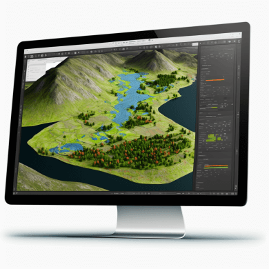
GIS (Geographic Information System) software is a tool that allows users to manage, analyze, and visualize data in a spatial context. It enables users to create, store, and analyze geographical data such as maps, satellite images, and demographic information. The software can be used in a wide range of applications including urban planning, resource management, environmental protection, and many others.
Types of GIS Software
- Desktop GIS Software: This type of software is installed on a local computer and is used for mapping and analyzing small to medium-sized datasets. Examples include ArcGIS Desktop and QGIS.
- Web-based GIS Software: This type of software is accessed through a web browser and is used for mapping and analyzing large datasets. Examples include ArcGIS Online and Google Earth Pro.
- Mobile GIS Software: This type of software is designed for use on mobile devices and allows users to collect and update geographical data while in the field. Examples include ArcGIS Collector and QField.
Key Features
- Data Management: GIS software allows users to import, manage, and store geographical data in a centralized database. It also provides tools for data quality control and data cleaning.
- Spatial Analysis: GIS software provides a variety of spatial analysis tools such as buffering, overlay analysis, and proximity analysis. These tools allow users to analyze and interpret geographical data in a meaningful way.
- Mapping: GIS software provides tools for creating maps, including tools for symbolizing data, labeling features, and creating legends. It also provides tools for map projection and coordinate systems.
- Data Visualization: GIS software provides a range of data visualization tools, including choropleth maps, heat maps, and 3D visualizations. These tools help users to understand and interpret geographical data in a visual way.
- Collaboration: Many GIS software solutions provide tools for collaboration, including tools for sharing data, creating and editing maps, and working with other users in real-time.
GIS Software List
- ArcGIS Desktop (by Esri) – A comprehensive GIS software for desktop that provides tools for data management, spatial analysis, mapping, and data visualization. It supports a wide range of data formats and includes advanced features such as 3D modeling and network analysis.
- QGIS – An open-source desktop GIS software that supports a wide range of data formats and provides many of the same features as ArcGIS Desktop. It is a popular choice for users who need a GIS software solution without the cost of a commercial product.
- ArcGIS Online (by Esri) – A web-based GIS software that provides tools for mapping, data analysis, and collaboration. It is designed for organizations that need to store and share large amounts of geographical data.
- Google Earth Pro – A free desktop and web-based GIS software that provides tools for mapping and data visualization. It includes features such as 3D modeling and historical imagery, and can be used for a wide range of applications.
- MapInfo Professional (by Pitney Bowes) – A desktop GIS software that provides tools for data analysis, mapping, and data visualization. It includes advanced features such as geocoding and network analysis, and supports a wide range of data formats.
- AutoCAD Map 3D (by Autodesk) – A desktop GIS software that provides tools for data management, spatial analysis, and mapping. It is designed for users who need a GIS software solution within the AutoCAD environment.
- GRASS GIS – An open-source desktop GIS software that provides a wide range of features, including spatial analysis, data management, and mapping. It is designed for advanced users and provides access to powerful command line tools.
- GeoServer – An open-source server-based GIS software that provides tools for publishing and sharing geographical data. It supports a wide range of data formats and provides access to powerful data processing tools.
- OpenLayers – An open-source web-based GIS software that provides tools for creating and integrating interactive maps into web applications. It supports a wide range of data formats and provides access to a large library of pre-built map components.
- Leaflet – An open-source web-based GIS software that provides tools for creating and integrating interactive maps into web applications. It is designed for developers who need a simple and flexible solution for creating maps, and supports a wide range of data formats.
- Global Mapper: Global Mapper is a GIS software developed by Blue Marble Geographics. It has a user-friendly interface and supports a wide range of data formats, making it easy to import and export data. Global Mapper also has a range of advanced tools for spatial analysis and cartography.
- ENVI: ENVI is a GIS software developed by Harris Geospatial Solutions. It is designed for the analysis of remote sensing and geospatial data, and includes tools for data management, spatial analysis, and visualization. ENVI is used by a wide range of industries, including government, defense, energy, and agriculture.
- PCI Geomatica: PCI Geomatica is a GIS software suite developed by PCI Geomatics. It includes a wide range of tools for data management, spatial analysis, cartography, and mapping. PCI Geomatica supports 2D and 3D mapping, and has a large user community that provides support and contributes to its development.
- ENVI LiDAR: ENVI LiDAR is a GIS software developed by Harris Geospatial Solutions. It is designed specifically for the analysis of LiDAR data, and includes tools for data management, spatial analysis, and visualization. ENVI LiDAR is used by a wide range of industries, including government, defense, energy, and agriculture.
- Surfer: Surfer is a GIS software developed by Golden Software. It is designed for the creation of 2D and 3D maps and includes tools for data management, spatial analysis, and visualization. Surfer is used by a wide range of industries, including government, defense, energy, and agriculture.
These are just a few of the many GIS software available. The right software for you will depend on your specific needs and the type of work you have
Applications of GIS Software
Urban Planning: GIS software is used by urban planners to analyze and visualize data related to urban development, such as population density, land use, and transportation networks.
Environmental Management: GIS software is used by environmental managers to monitor and manage natural resources, such as water and air quality, wildlife habitats, and protected areas.
Disaster Management: GIS software is used by disaster management organizations to respond to emergencies, such as hurricanes, earthquakes, and wildfires. It provides real-time information about the location and extent of a disaster and helps to prioritize response efforts.

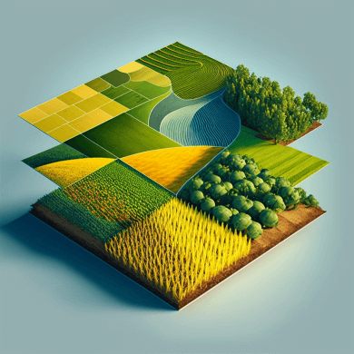
Agriculture: GIS software is used by the agriculture industry to monitor and manage crops, including crop yields, soil quality, and irrigation systems.
Conclusion
GIS software is a powerful tool for managing, analyzing, and visualizing geographical data. It provides a range of features, including data management, spatial analysis, mapping, data visualization, and collaboration. It is used in a wide range of applications, including urban planning, environmental management, disaster management, and agriculture. The continued development and improvement of GIS software will continue to play a crucial role in shaping the future of our world.
- Geospatial Intelligence and Machine Learning Applications in the Air Force: An In-Depth Analysis

- Honorary Doctorate – ‘Dr’
- Remote Sensing of Environment

- Geospatial Bill of India 2022

- NAAS Rating 2023 PDF | NAAS Score of Science Journals (Effective from January 1, 2019, 2021, 2022, 2023)| NAAS Rating
