Geospatial Technology for Municipal Government
Geospatial technologies, such as geographic information systems (GIS) and global positioning systems (GPS), can be used by municipal governments to improve service delivery in a number of ways. These technologies can be used to identify the location of assets, such as water pipes, roads, and buildings, and to track the maintenance and repair of these assets.
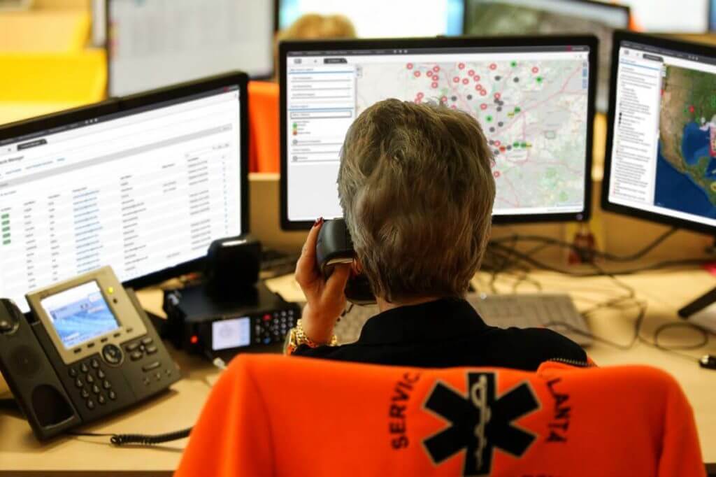
GPS can be used to track the location and movements of municipal assets, such as vehicles and equipment, in real-time. This can help municipalities optimize routes and schedules, reduce fuel consumption and maintenance costs, and improve response times to service requests.
They can also be used to identify the location of residents and businesses, and to map the distribution of population and economic activity within the municipality. This can be helpful for planning and delivering services, such as waste collection, public transportation, and emergency response.
Geospatial technologies can also be used to gather data on the environment and natural resources within the municipality, such as air and water quality, land use, and vegetation cover. This information can be used to inform decision-makers and to develop policies to protect and manage these resources.
Geospatial technologies can be used by municipalities to improve service delivery in a variety of ways. Some examples include:
1. Mapping and visualizing data:
Geospatial technologies can help municipalities to map and visualize data about their communities, such as population demographics, land use patterns, and infrastructure. This can help them to identify patterns and trends, and to make informed decisions about how to allocate resources and deliver services.
2. Improving emergency response:
Geospatial technologies can be used to track the location of emergency vehicles and to route them more efficiently to the scene of an emergency. This can help to improve response times and save lives.
3. Enhancing public safety:
Geospatial technologies can be used to monitor crime hotspots and to deploy police and other emergency services more effectively. This can help to reduce crime and improve public safety.
4. Facilitating transportation planning:
Geospatial technologies can be used to plan and optimize transportation routes and to improve traffic flow. This can help to reduce congestion and improve mobility.
5. Managing natural disasters:
Geospatial technologies can be used to monitor and respond to natural disasters, such as floods, wildfires, and earthquakes. This can help to minimize damage and save lives.
Overall, geospatial technologies can help municipal governments improve the efficiency and effectiveness of their service delivery, leading to better outcomes for their communities.
FAQs:
-
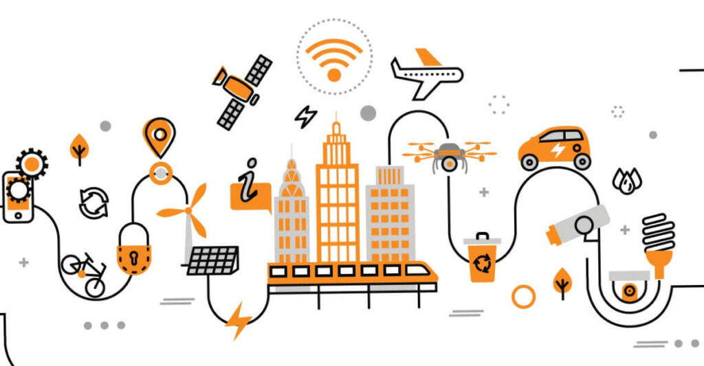
How Geospatial Technology is used in Municipal Government to improve service delivery
GPS can be used to track the location and movements of municipal assets, such as vehicles and equipment, in real-time. This can help municipalities optimize routes and schedules, reduce fuel consumption and maintenance costs, and improve response times to service requests.
-
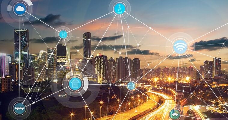
Is Geospatial Technology helpful for the development of smart city?
Yes, geospatial technology can be very helpful in the development of smart cities. Smart cities are urban areas that use technology and data to improve the quality of life for their residents and visitors. Geospatial technologies, such as GIS and GPS, can play a key role in this by providing the spatial data and analysis needed to plan and implement smart city initiatives.
-
How Geospatial Technology can be useful in town/ Urban planning?
By providing the data and analysis needed to make informed decisions. For example, GIS can be used to create digital maps and 3D models of a city’s infrastructure, including roads, buildings, and utility networks. This information can be used to optimize traffic flow, improve energy efficiency, and identify areas for development or redevelopment. GIS can also be used to track and analyze the movement of people and goods within a city, helping to improve the efficiency of public transportation and logistics systems.
-
What is geospatial technology used for
Urban planning, Disaster Management, Traffic Management etc. Click here
-
Which objection do citizens of an area commonly raise about geospatial technology?
One common objection that citizens of an area may raise about geospatial technology is the concern about privacy. Geospatial technology, such as GPS, can track and record a person’s location, which some people may find invasive or a violation of their privacy. Additionally, geospatial data may be collected and used by government agencies or private companies for various purposes, such as tracking traffic patterns or targeting advertising, and some people may object to the collection and use of this data without their consent.
-
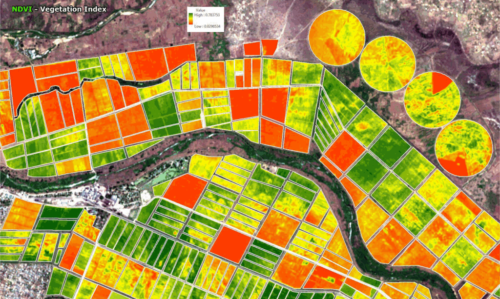
Application of geospatial technology in environmental management
In environmental management, geospatial technology can be used in a variety of ways to support decision-making and inform the development of environmental policies and programs. Some examples of how geospatial technology can be applied in environmental management include:
Mapping and monitoring environmental resources: Geospatial technology can be used to create detailed maps of natural resources, such as forests, wetlands, and water bodies. These maps can be used to track changes over time and identify areas that may be at risk from environmental degradation.Assessing environmental impacts: Geospatial technology can be used to assess the potential impacts of development projects, such as roads, pipelines, or mining, on the surrounding environment.
Managing natural disasters: Geospatial technology can be used to track and predict the movements of natural disasters, such as hurricanes and floods, and to help emergency responders plan their response efforts.
Monitoring air and water quality: Geospatial technology can be used to monitor air and water quality in real-time, allowing environmental managers to identify areas that may be at risk from pollution or other environmental hazards.
Managing land use and land cover: Geospatial technology can be used to monitor land use and land cover changes, such as the conversion of natural areas to urban or agricultural land. This can help environmental managers identify areas that may be at risk from land use changes and develop strategies to protect these areas.
-
What is meant by geospatial technology?
Geospatial technology refers to a range of tools and techniques that are used to collect, store, analyze, and visualize data that is tied to a specific location on the Earth’s surface. These technologies are used in a wide range of applications, including mapping, surveying, navigation, land management, environmental monitoring, and many others.
Similar Articles:
- Geospatial Intelligence and Machine Learning Applications in the Air Force: An In-Depth Analysis

- Honorary Doctorate – ‘Dr’
- Remote Sensing of Environment
- Geospatial Bill of India 2022
- IIRS, ISRO: Engagement of Technician (Diploma Holders) & Graduate (Engg. / Tech.) Apprentices